1. An integer between 1 and 339 is selected.
![[illustration]](fiord2.jpg)
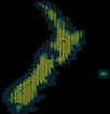
lower lefthand corner of NZ map showing numbers
2. This is translated into an NZMS 260 map code, using a map of New Zealand which has the NZMS 260 series maps marked and numbered. The numbers start from the top of the westernmost column (map A44), continuing down the column before leaping to the top of the next one.
Numbers 338 and 339 relate to the two Chatham Islands sheets.
3. The computer selects random coordinates relative to the southwestern corner of the map. X is between 0 and 399, while Y is limited to 0-299. Added to the absolute coordinates of the corner spot, this gives a valid NZMS 260 map reference.
4. A compass direction is randomly selected. This is intended as a guide only, giving the filmmakers a direction in which to first point their camera.
5. The coordinates are sent to the printer and recorded on disk.
6. If the indicated location appears to be too far offshore, the computer is instructeded to pick another one (starting from 1 above) with out incrementing the counter.
7. the counter is incremented, and if it is less than thirteen the process is repeated to find the next location.
8. Now there will be a printed list of at least thirteen randomly selected coordinates. The relevant maps are purchased and the first 12 valid locations are visited and filmed. The remainder of the list is ignored. Validity depends on the location being within 1 kilometre of solid land. The reasons for this are adequately discussed in the original proposal, note 7.
|
|
word index | ||||||||||||||||||||||||